Use of Maps

Executive World Map hanging on the wall  (picture taken in evening)

Imagine how you could use your Lightravels® light up wall map!

The Lightravels® collection of maps can be used for a variety of purposes.

The most common uses are for Personal, Business, Religious, Educational, and Military.

However, the options are endless!

Lightravels_Misc_1

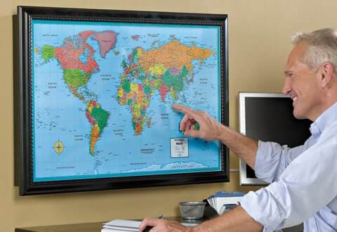
Track your travels in bright lights and color!family picture

People have used our maps to track the locations of the cruises and the vacations they’ve taken; the marathons they have run; major league baseball fields, national parks, state capitals, and worldwide cities visited, etc.
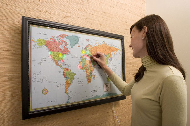
Ideas:

  • Use one color peg for each trip, so that you can distinctly see the different trips.
  • Use one color peg to show the places you want to go, another color to denote the places you have been
  • Use one color peg to denote the national parks visited and another for the state capitols you've been to, etc.
  • Use one color peg for each of your family members, to easily show off each person's travels.

Track your locations in bright lights and color!business picture

Companies have used our maps to denote their sales territories or the locations of their stores; the locations of their customers; the locations of their oil rigs; locations of credit card fraud 'hot' or 'trouble' spots around the world, etc.

Ideas:

  • Use one color peg for each each year (or designated time frame) for when you opened each location.
  • Use one color peg for each area you want to denote within a sales region.
  • Use a variety of different colored pegs to show off your customer locations.

Track the missions you support in bright lights and color!family picture

Religious organizations have used our maps to highlight the locations of the missionary work they support; the locations of their various sister and affiliate organizations, etc.


Ideas:

  • Use one color peg for each each year (or designated time frame) for when you started to support each location.
  • Use a variety of different colored pegs to show off the locations of your various missionaries.

A fun and unique way to grab the student's attention and interest!business picture

Teachers and schools have used our maps to educate their students in geography, history, topography, etc.

Ideas:

  • Use colored pegs to show the schools within your district.
  • Use one color peg for the state capitols or major cities that your students are currently studying, another color for historical sites, etc.

Track your military experience in bright lights and color!family picture

The military and their personnel have used our maps to uniquely display various tactical areas they are involved with; individuals have tracked the places they have served, etc. Hang a world map in your retired Vets organization's hall to proudly display where each member has served.


Ideas:

  • Use color pegs to highlight where you have served.
  • Use color pegs to show where loved ones have been and are currently stationed.
  • Use one color peg, such as green, for the areas and/or perimeter within the safe zone.
  • Use one color peg, such as yellow for areas and/or perimeter within the caution zone.
  • Use one color peg, such as red for areas and/or perimeter within the hot or unsafe zone.